
TL;DR

Prime made for students and young adults
- Fast, free delivery for dorm and study essentials
- Prime Video and Amazon Music included
- Member-only deals
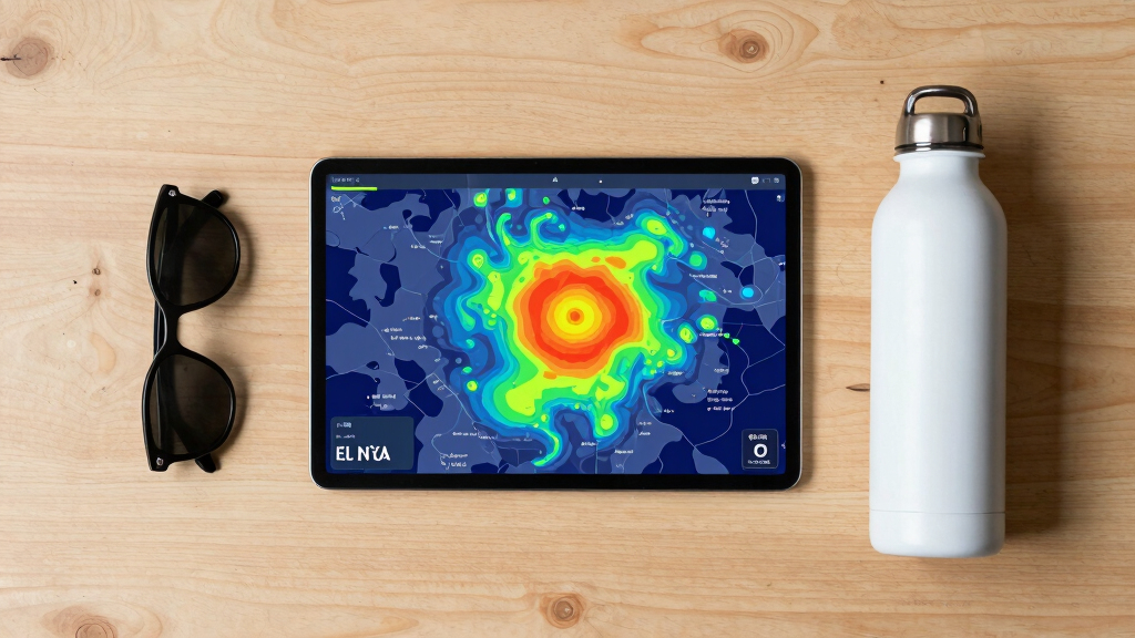
The probability of a ‘Super’ El Niño has increased, according to climate forecasts. This could lead to significant weather changes in Utah, but details are still developing. Experts warn residents to stay informed.
Climate scientists now estimate an increased likelihood of a ‘Super’ El Niño forming this year, raising expectations of significant weather impacts in Utah. This development is based on recent atmospheric and oceanic data, and it matters because such an event can cause extreme weather conditions, including heavy snowfall, droughts, or intense storms.
According to the National Weather Service and climate experts, the odds of a ‘Super’ El Niño — a particularly strong phase of the El Niño Southern Oscillation — have risen in recent weeks. The Climate Prediction Center (CPC) has updated its forecasts, indicating a greater than 60% chance of a major El Niño forming this year, compared to earlier estimates of around 40%.
This shift is driven by warmer-than-average sea surface temperatures in the central and eastern Pacific Ocean, along with atmospheric patterns that favor El Niño development, according to NOAA’s climate models. While no official declaration of a ‘Super’ El Niño has been made, experts suggest the conditions are aligning for such an event, which could last through the winter months.
For Utah, this could mean increased likelihood of both heavy snowfall and drought conditions, depending on how the El Niño develops and interacts with local weather systems. Authorities and meteorologists emphasize that while the probability has increased, the exact strength and timing of the event remain uncertain, and forecasts can evolve as new data emerge.
Potential Weather Extremes in Utah from a Major El Niño
The increased odds of a ‘Super’ El Niño are significant because such events are associated with heightened weather variability. Utah could experience more intense winter storms, leading to heavy snowfall and flooding, or conversely, dry conditions that threaten agriculture and water supplies. These shifts can impact transportation, infrastructure, and public safety.
Understanding the potential for a stronger El Niño allows local authorities and residents to prepare for a range of weather scenarios. It also influences water resource management and emergency planning, making the forecast crucial for statewide planning efforts.
As an affiliate, we earn on qualifying purchases.
Recent Climate Trends and Historical El Niño Events
El Niño–Southern Oscillation (ENSO) cycles occur roughly every 2 to 7 years, influencing global weather patterns. The last significant El Niño event occurred in 2015–2016, which brought severe weather changes across the U.S., including heavy snowfall in Utah during winter 2015-2016. Historically, ‘Super’ El Niño events, characterized by exceptionally high sea surface temperatures, tend to produce more extreme weather impacts.
Recent climate models and oceanic data indicate a warming trend in the Pacific Ocean that aligns with conditions seen before past major El Niño events. The current forecast updates from NOAA suggest the possibility of this pattern intensifying, but the exact timing and strength remain uncertain.
Experts note that while the probability of a strong El Niño has increased, climate variability means outcomes can differ significantly from previous events, and local impacts depend on multiple interacting factors.
“The rising likelihood of a ‘Super’ El Niño this year is a significant signal that we could see more extreme weather patterns, both globally and here in Utah.”
— Dr. Lisa Smith, NOAA Climate Scientist
As an affiliate, we earn on qualifying purchases.
Forecast Confidence and Possible Variability
Although the probability of a ‘Super’ El Niño has increased, the exact strength, timing, and duration are still uncertain. Climate models can diverge, and atmospheric conditions may change, affecting the final outcome. Experts emphasize that forecasts are subject to revision as new data becomes available, and residents should stay informed through official sources.
As an affiliate, we earn on qualifying purchases.
Monitoring and Preparing for Evolving Climate Signals
Meteorologists will continue to track oceanic and atmospheric indicators, updating forecasts as new information emerges. Authorities recommend that Utah residents prepare for a range of weather scenarios, including potential heavy snowfall or drought conditions, depending on how the El Niño develops. Emergency management agencies are also reviewing contingency plans in case of extreme weather events.
In the coming months, climate agencies will issue more precise forecasts, and local officials will provide guidance on preparedness measures. The development of a ‘Super’ El Niño remains a possibility, but its actual impact will depend on how atmospheric conditions evolve.
As an affiliate, we earn on qualifying purchases.
Key Questions
What is a ‘Super’ El Niño?
A ‘Super’ El Niño refers to an exceptionally strong phase of the El Niño Southern Oscillation, characterized by very high sea surface temperatures in the Pacific Ocean, often leading to extreme weather events globally.
How could a ‘Super’ El Niño affect Utah?
It could lead to more intense winter storms and heavy snowfall, or alternatively, drought conditions, depending on how the event unfolds. These impacts can influence water supplies, agriculture, and infrastructure.
How certain are the current forecasts?
While the odds of a major El Niño have increased, the exact timing and strength remain uncertain. Climate models are continually updated as new data becomes available, so forecasts may change.
Should residents prepare now?
Yes. Given the potential for significant weather impacts, residents and authorities are advised to stay informed and review emergency preparedness plans for extreme weather scenarios.
When will more definitive forecasts be available?
Climate agencies will continue monitoring oceanic and atmospheric conditions, releasing updated forecasts over the next few months as the El Niño development becomes clearer.
Source: google-trends
Halloween Picks
halloween
As an affiliate, we earn on qualifying purchases.